| Hjem > Slåttemyra > Mire investigations in the rural district of Orkdal, Sør-Trøndelag county, central Norway | ||
|
7th European Phillips contest for young scientists and inventors 1975, Eindhoven
Mire investigations in the rural district of Orkdal, Sør-Trøndelag county, central Norway |
||
|
By Tor Øystein Olsen English Summary 1975 The purpose of the present work has been to carry out a botanical investigation of the mire vegetation in the rural district of Orkdal, in the county of Sør-Trøndelag, Central Norway. The study has been conducted with a special view to estimating the preservation worthiness of the mires investigated. Field work started and finished in 1974, and the results are presented in a handwritten paper 164 pages long. A summary of this paper is given below. Chapter I (pp. 1–9) opens with a survey of national and international plans for mire nature reserves. In connection with the Norwegian national plan, the mires investigated have been ranked in order of preservation worthiness. Out of these mires a provisional list of 10 has been selected as being worthy of preservation from an international point of view (as a result of proposals put forward by the Telma project of the International Biological Programme of Unesco). In addition, 47 mires scattered about the country are considered especially worthy of preservation in the light of national interest in conserving examples of the most important types. So far, six mires have been protected in Norway as nature reserves (cf. Fig. 2a in the original paper). In the work on the national plan for mire nature reserves, the following two principal criteria for mire preservation have been observed:
Chapter II (pp. 13–16) provides further information about the methods employed in the investigations, which were conducted throughout the summer of 1974. Altogether, 33 mires, large and small, in Orkdal, were visited and investigated. These mires were selected in advance and marked out on topographical maps of a scale of 1:50 000 (M711 series NGO). The first weeks of the field season were devoted to learning about mosses and other cryptogams: the problematic peat-mosses (Sphagnum), in particular, caused many difficulties in the opening phase of this work. An attempt was also made to obtain a thorough introduction to the principles of mire sociology. Cand. real. Kjell Ivar Flatberg, Botanical Department, University of Trondheim, assisted me with guidance and advice, and also accompanied me on trips into the field. Most of the field season was devoted to investigation of the mires. An average of one to two mires were visited each day. For each mire efforts were made to carry out a survey of the main hydrotopographical conditions and the most important plant communities on the mire (notes were made in a special field notebook). However, the bulk of the work was concentrated on compiling as complete a list as possible of the different species on the mire. For each mire a field checklist, containing all vascular plants, all peat-mosses, and an assortment of the most important bryophytes and lichens observed, was completed (see Fig. 53). Collections of different plants were made from almost all the mires. These collections are now preserved at the herbarium of the Royal Norwegian Society of Sciences, The Museum, Botanical Department. Altogether, about 200 collections were made. The field investigations were restricted by bad weather, as it rained practically every day. After the field work had been completed, the notes on the mires visited were collated and analyzed. Finally, the mires were grouped according to their preservation worthiness. The following categories were used for this purpose:
Chapter III (pp. 17–34) is devoted to definitions and explanations of mire and mire terms, and to classifications of mires. Mires may be variously defined, depending on the criteria employed biological, geological, or geographical. In a biological sense a mire is a growing place and a substrate for a certain type of vegetation. Geologically, a mire consists of accumulated layers of peat, while geographically it is an area of land. By geographical criteria a mire can be defined as follows: "A mire is an area with peat and a hydrophilic vegetation which itself is able to make up peat." (After Flatberg 1970.) The soils of mires are called peat, and consist mainly of the remains of macrophytes that once grew on them. In hydrological terms one can distinguish between two main types of mire:
The minerogenous mires may in turn be divided into:
All these types may exist in one and the same mire, or, more correctly, in the same mire complex. A part of a mire with a uniform appearance is called a mire element. Within the mire elements smaller units, like depressions and elevations, may be distinguished. These are called mire structures. In the main work there are plenty of examples of different kinds of elements and structures found on mires (pp. 22–23). On the basis of hydrological and geographical criteria, two main types of mire complexes exist:
Within both types a distinction is made between several main subtypes. Fig. 8 provides a schematic presentation of the different types of mire complexes in Norway. It is also possible to classify the mires from a vegetation standpoint. In Norway there are marked regional differences in the vegetation of the mires along both a north–south and an east–west gradient, and also at different altitudes. Within each mire the composition of the vegetation varies, and three main local vegetation gradients can be distinguished:
These three vegetation gradients are the results of different ecological conditions on the mire, and also express the changes in ecology at different parts of the mire. In my work (pp. 30–34) I have defined the vegetation gradients in detail. Here it may briefly be mentioned that along the poor–rich gradient, the mires are divided into ombrotrophic mire and minerotrophic mire. The minerotrophic mires are subdivided into poor, intermediate, rich, and extremely rich mires; the different types being characterized by certain plant species. Fig. 12 represents a survey of how different species are distributed in mire vegetation along the poor–rich gradient in Central Norway Along the mud-bottom–hummock vegetation gradient, according to the species composition, a division can be made into four units: 1) Mud-bottoms, 2) Carpets, 3) Lawns, and 4) Hummocks (1–4 expressing wetness). Chapter IV (pp. 35–36) provides a survey of nomenclature problems met with, and of the flora used during the work. Special attention is drawn to taxonomical problems in the critical bryophyte genus Sphagnum. Chapter V (pp. 37–41) is devoted to general aspects of the investigation area (Orkdal), such as geographical position, size, delimitation, geology, climate, etc. The rural district of Orkdal is situated in Sør-Trøndelag county, Central Norway, around the Orkdal fjord and the lower parts of the Orkdal valley, where the River Orkla runs. For a more exact location, the reader is referred to Figs 27 and 28. Large expanses to the west lie above the timberline (about 400–500 meters above sea-level), and the highest peak is Omnfjellet (847 m). However, most of the land area is situated below the timberline, and here spruce forest dominates. The lower part of the valley consists of the wide, level banks of the Orkla, with terraces of clay and gravel on both sides. Most of the farming is concentrated in these areas. Geologically, the Orkdal region is complex. The areas west of the River Orkla are dominated by gneisses, granites, and quartzes, with scattered cambrosiluric sediments. East of Orkla the rocks are partly basic effusives, among them green schists. Climatically, the western parts of Orkdal are characterized by high precipitation (1000–2000 mm precipitation a year), while the eastern parts have an annual precipitation of only 500–1000 mm. The mean temperature for the coldest month (January) in the middle of the region is about –5˚ C, and for the warmest month (July) between +12˚ and +16˚ C. Chapter VI presents a survey of the mires visited. In Fig. 28 the positions of these mires are marked out and given reference numbers from 1 to 33. Each mire is exactly localized by the UTM system, and the classified preservation category is reported. In Chapter VII (pp. 44–133) are contained the descriptions of each of the mires visited and investigated. The following points are thoroughly dealt with for each mire:
As an example of the treatment of one single mire, mire locality 2 is selected (pp. 47–49); this is one of the Orkdal mires especially worthy of preservation from a national viewpoint. 2. Kammyra. NR 34,05Position: The mire is situated between Berbuskammen and Husåsen, about 3 km NW of Svorkmo, about 330 m above sea-level. Investigations, material: I visited the mire in connection with my mire investigations on 15 July and 13 October 1974. (A. Moen 1983: 69, p. 76) Utilization and influence: In the northeastern ombrotrophic parts of the mire, some pollution occurs. A short fence crosses the mire in the east-northeast and here, too, are remains of early peat cuttings. The mire complex, vegetation, and flora: Due to the topographical conditions, this mire consists of many parts with different directions of drainage. Fig. 45 comprises a detailed vegetation map on which the directions of drainage are indicated by arrows. This figure also shows there exist three ombrotrophic parts, separated from each other on the mire (A, B, and C). In the main, the vegetation of these ombrotrophic parts is similar and consists of a mixture of hummocks and hollows. The hummocks are dominated by Cladina, Sphagnum nemoreum = S. capillifolium, S. fuscum, Pleurozium schreberi, and Rhacomitrium lanuginosum = Racomitrium lanuginosum. In the field layer Calluna vulgaris is the most frequently occurring species, but also Rubus chamaemorus, Eriophorum vaginatum, Empetrum, and Vaccinium-species are common. Sphagnum compactum is the most important of the hollow species in the bottom layer; S. tenellum is also common. The field layer in the hollows is dominated by Scirpus caespitosus = Trichophorum cespitosum cespitosum, with frequent occurrences of Drosera anglica and Scheuchzeria palustris. In the carpets Rhynchospora alba, Drosera anglica and Carex limosa were noted. The small mire tarn in Area A is minerotrophic, and species like Menyanthes trifoliata, Nymphaea candida, Scheuchzeria palustris, and Sphagnum cuspidatum occur. While Areas B and C are sharply delimited from the surrounding minerotrophic C areas, Area A, on the contrary, is rather diffusely delimited. Fig. 45 clearly shows that most of the mire is minerotrophic, and extremely rich, with rich and intermediate mire elements predominating. The richest parts of the mire are marked with an X. Plants of special interest here are Schoenus ferrugineus, Parnassia palustris, Tofieldia pusilla, Selaginella selaginoides, Eriophorum latifolium, Carex panicea, Dactylorchis incarnata = Dactylorhiza incarnata, Equisetum palustre, Euphrasia sp., Carex chordorrhiza, and C. flava. Carex rostrata, and to some extent C. lasiocarpa, are the two dominant species. In the bottom layer "brown mosses" are of the greatest importance, among them Scorpidium scorpioides, Campylium stellatum, Calliergon sarmentosum = Sarmentypnum sarmentosum, Cinclidium stygium, Drepanocladus revolvens = Scorpidium cossonii, D. badius = Loeskypnum badium, and Sphagnum warnstorfii. Intermediate minerotrophic elements are also rather common the mire. The bottom layer here is dominated by Sphagnum teres, S. warnstorfii, S. subfulvum, S. subnitens, S. subsecundum coll., and Drepanocladus exannulatus = Sarmentypnum exannulatum, while in the field layer Scirpus hudsonianus = Trichophorum alpinum is common. Poor minerotrophic vegetation mainly occurs as diffuse small spots among ombrotrophic vegetation and as scattered soaks. Eriophorum angustifolium, Carex rostrata, and Scirpus caespitosus = Trichophorum cespitosum cespitosum are the most frequent field species, and Sphagnum papillosum dominates the bottom layer. In the carpets Rhynchospora alba, Carex limosa, and Drosera anglica were noted. Geographical interesting species: The rich mire species Dactylorchis incarnata = Dactylorhiza incarnata has been recorded only five times in Orkdal. Hulten (1971) reports the species with scattered localities throughout the country (north to Troms, cf. Figs 47, 49). In Fig. 48 the extremely rich mire species Schoenus ferrugineus is mapped (see also Figs 46a, b). Its main distribution area in Norway seem to be the provinces of Trøndelag, and it is rare in most other places. In Orkdal Schoenus is reported from two mires. In its ecological demands and distributional patterns Schoenus shows great similarities with Carex lepidocarpa. In addition, there are records of species which in Orkdal seem rather rare, such as Utricularia ochroleuca, Carex chordorrhiza, Rhynchospora alba, and Drepanocladus badius = Loeskypnum badium. Preservation proposal: The Kammyra mire has to be classified as "Specially worthy of preservation nationally", and must be included among the mires in the Norwegian national plan for mire nature reserves. Together with Jakobsmyra (see p. 50), Svorkdalsmyran (p. 83), and Søvasslikjølen (p. 77), Kammyra is one of the mires in Orkdal most worthy of preservation. Also included in Chapter VII are distributional maps for geographically interesting species (see, for instance, Figs 78, 80, 81, 90, 91, 92, 97, 108, etc.). Many of these species have not been reported earlier from the Orkdal region. Chapter VIII (pp. 134–146) embraces a survey of the species reported from the mires visited in Orkdal. A tabular survey is given in Figs 131a, b, in which most of the recorded species are included. The table is commented on in pp. 135–140. The commonest mire species in Orkdal are listed on pp. 135–136 (species reported from 100–80% of the mires visited). Among these species Andromeda polifolia, Calluna vulgaris, Empetrum spp., Oxycoccus ssp., Picea abies, Pinus sylvestris, Rubus chamaemorus, Carex rostrata, Eriophorum vaginatum, Scirpus caespitosus = Trichophorum cespitosum cespitosum, Sphagnum fuscum and S. papillosum are reported from all the mires visited. As rare mire plants in Orkdal are classified those species which are noted in 20 % or less of the mires investigated. Thirty-three species and three hybrids are mentioned belonging to this group. Of these, 10 are reported from only one mire each. The floristic elements represented on the mires investigated are tabled on pp. 140–145. Three different main types of element are recognized, the Fennoscandian distribution patterns being taken as a basis:
Of special interest in Orkdal are the western elements with a coastal distribution pattern in Fennoscandinavia. Thirty-two species in Orkdal are classified as belonging to this element. Of these, Carex hostiana, Dryopteris oreopteris = Oreopteris limbosperma, Erica tetralix, Juncus bulbosus f. fluitans, J. squarrosus, Lycopodium inundatum = Lycopodiella inundata, Myrica gale, Pedicularis sylvatica, Potamogeton polygonifolius, Rhynchospora fusca, Riccardia multifida, Sphagnum angermanicum, S. molle, S. strictum, and Siphula ceratites are recorded only from the western parts of Orkdal and do not cross the River Orkla. The other two elements are also richly represented in the mire flora of Orkdal, so as a conclusion it may be said that the mire flora of Orkdalen is characterized by elements of, and the meeting of, oceanic, southern, eastern, northern, and alpine species. This makes Orkdal, from a regional point of view, a very interesting botanical subject. Chapter IX (pp. 146–160) comprises an alphabetical list of all the species mentioned in my paper. At the end of the chapter there is a survey of, and definitions of, the mire terms used. Chapter X (pp. 161–164) completes the work with a comprehensive list of references to the literature consulted and quoted in the text.
Orkanger May 1975 Tor Øystein Olsen
|
||
|
|
Oversikt over arrangementer:
:Årbok Maridalens Venner 2025

:
Maridalsspillet

Video av Johnny Fagerstrøm 2021:
Film om Maridalen

:
Margaretakirken i fordums drakt video

:
Maridalen. NRK 1972

:
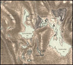
Digitalisert kart over Maridalen

:
Historiske ferdselsveier fra Oslo gjennom Nordmarka til Hakadal og Hadeland

Ansvarlig redaktør: Tor Øystein Olsen. Støtt Maridalens Venners arbeid - kontonr. 0530 58 56349